


Areas of Assessment
Inverurie and Port Elphinstone
A map of the watercourses assessed at Inverurie and Port Elphinstone in relation to their wider catchments is provided below, along with plans of the actual modelled lengths of the watercourse on each community:
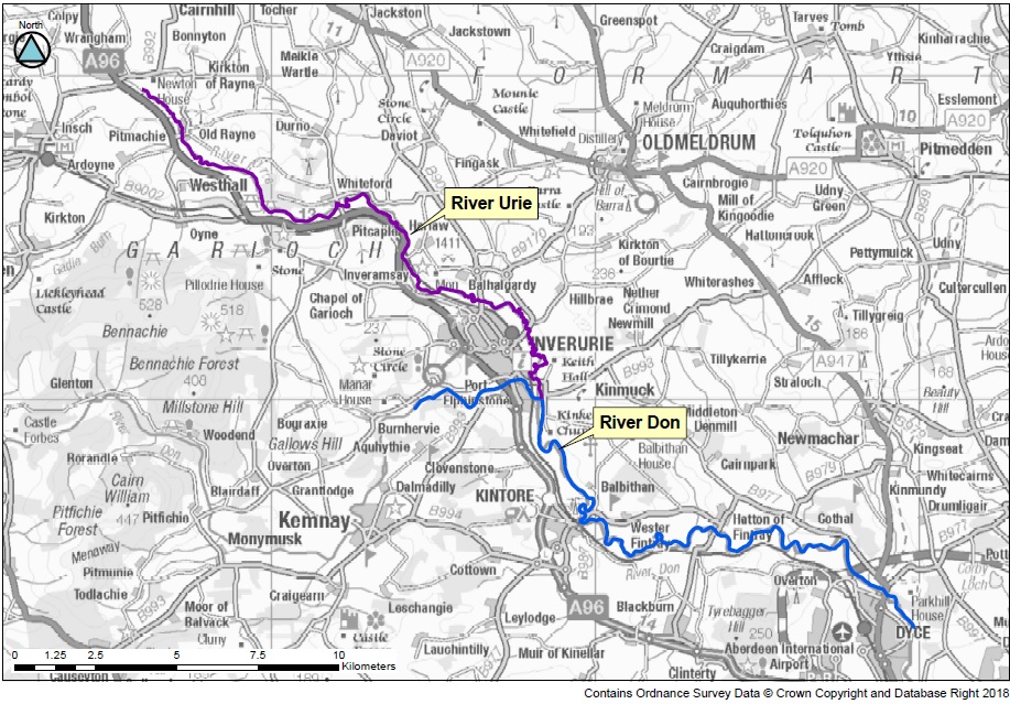
Modelled Reaches
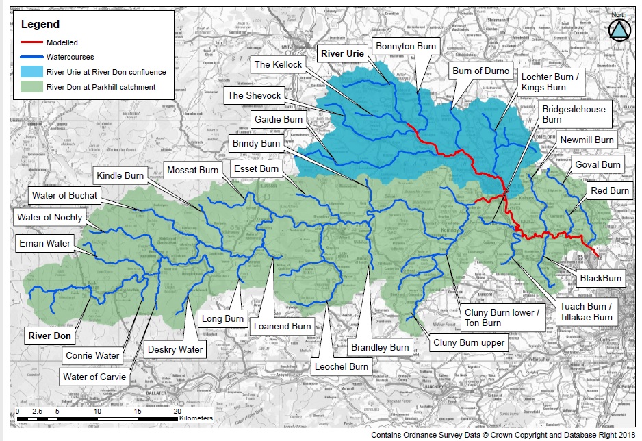
Catchment Watercourses
Additional Assessment Areas
Based on SEPA's Flood Risk Management Strategy and the North East Local Flood Risk Management Strategy the following areas were also selected for further assessment. Links to the flood study websites are to follow: